
 January 22, 2026
Gila National Forest to begin prescribed pile burns
Favorable weather conditions with increased moisture forecasted
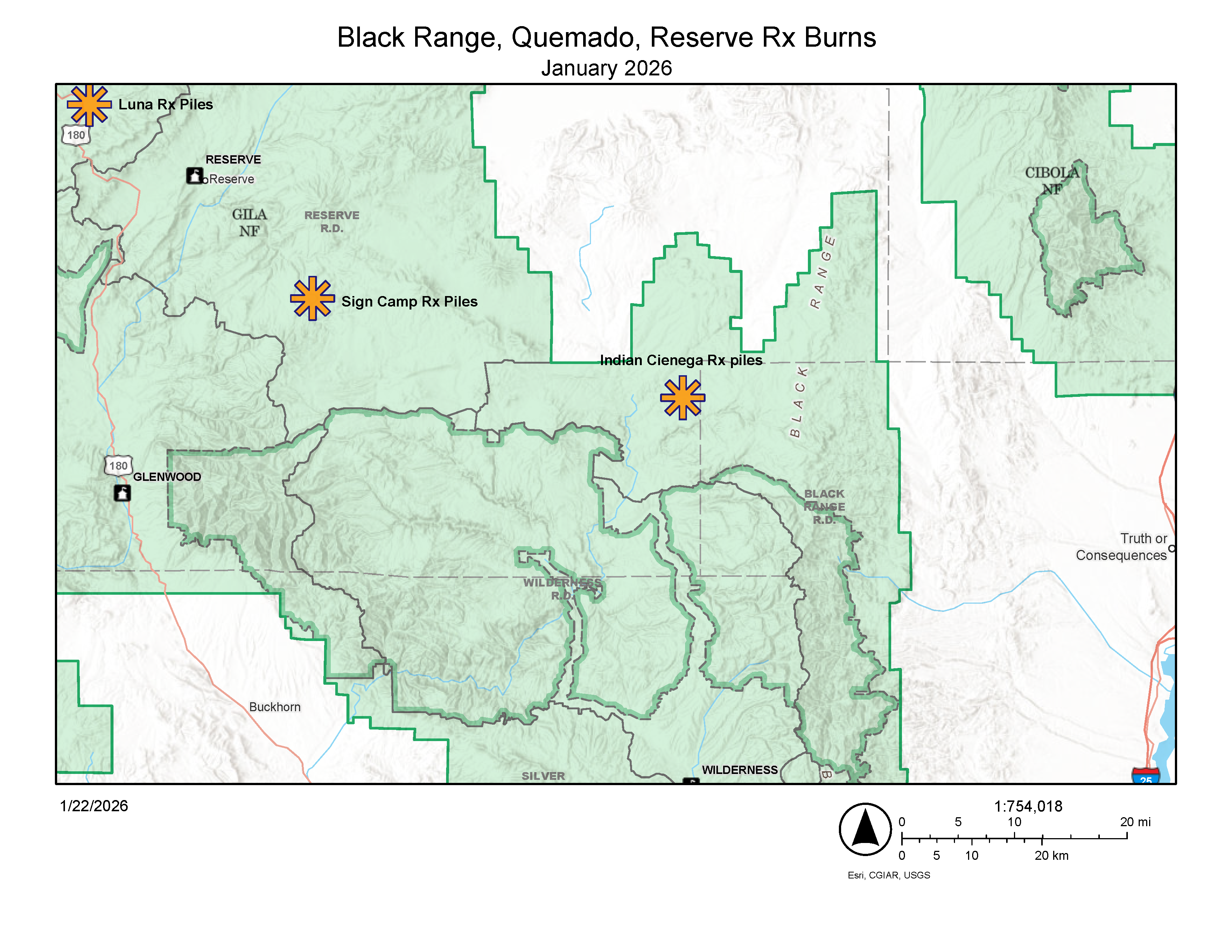
SILVER CITY, N.M., Jan. 22— The Gila National Forest intends to implement prescribed fire operations on the Black Range, Quemado, and Reserve Ranger Districts this week, pending weather conditions and all required approvals. Fire personnel will assess weather and environmental conditions over the next month and conduct targeted prescribed burns when appropriate. We use prescribed fires to help reduce overgrown vegetation to help protect local communities, infrastructure and natural resources from wildfires.
Prescribed fires planned for the area include:
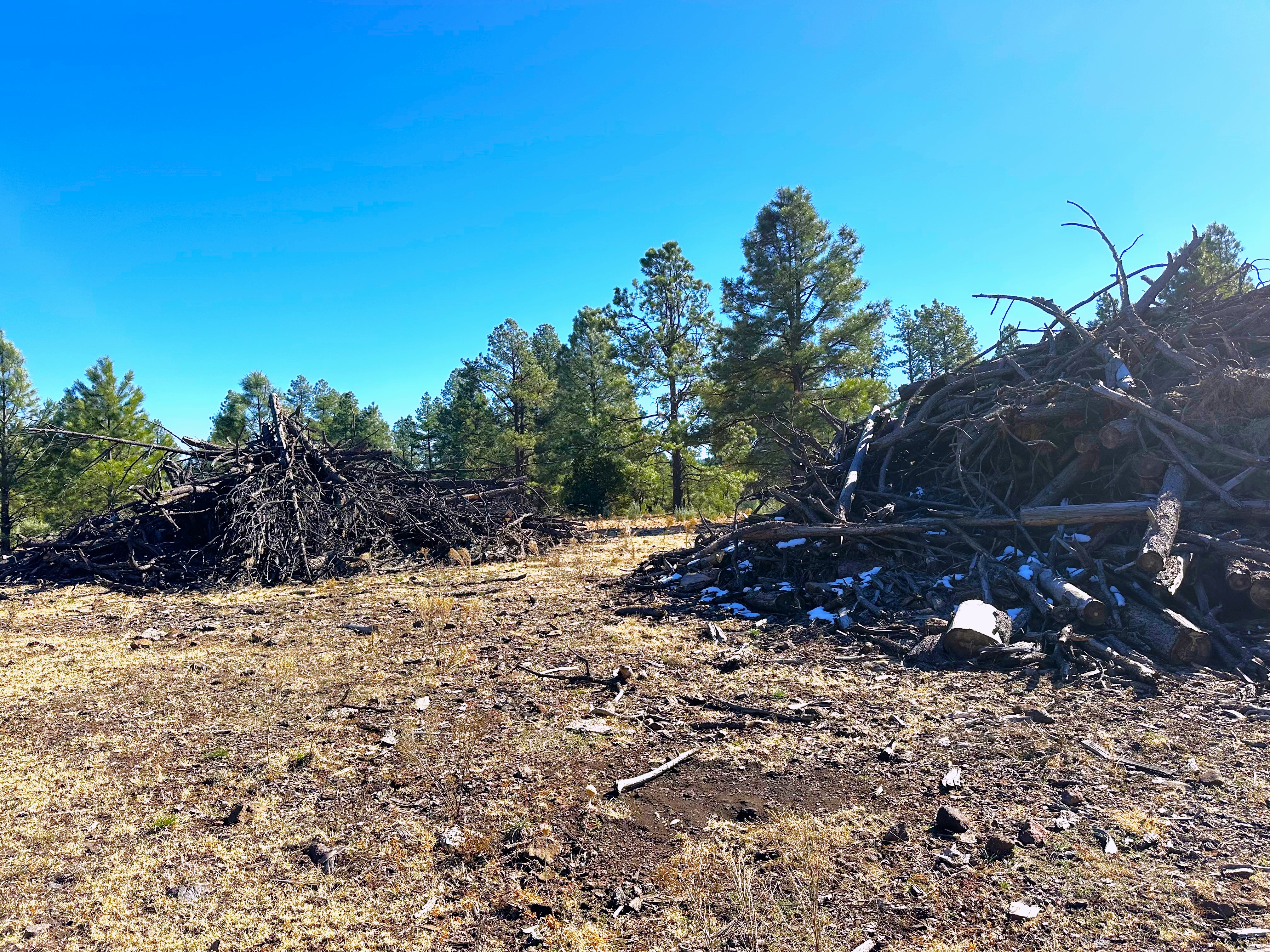
- Black Range: Beginning Friday, Jan. 23 – Slash piles in the Indian Cienega area along New Mexico Highway 59 between mileposts 23 and 31, approximately 22 miles west-northwest of Winston, NM. Smoke will likely impact visibility along Highway 59.
- Quemado: Beginning Monday, Jan. 26 – Machine piles leftover from previous logging sales south of Luna, near Sawmill Road. This is a continuation of prescribed burn work in the area that started two weeks ago. Smoke will likely be visible for local Luna residents and along U.S. 180 in the Luna vicinity.
- Reserve: Beginning Monday, Jan. 26 – Machine piles leftover from previous logging sales in the Sign Camp area near Forest Service Road 141, approximately 12 miles southeast of Reserve. Smoke will likely be visible along FS Road 141.
Watch for warning signs along roads near all prescribed fire areas before and during burns.
If traveling in any of these areas, watch for fire vehicles and firefighters along roadways and slow down and turn on your headlights if you encounter smoke on the road. Smoke may settle into valley areas, especially during overnight and early morning hours. For more detailed information about air quality, visit AirNow online or download the app.
We will evaluate weather conditions in the hours before a burn begins. If conditions warrant, scheduled prescribed fire activities may be canceled.
The public can stay informed on scheduled prescribed fires through the forest website and social media. We will notify county emergency management officials when burning begins.


Comments are closed.