
 February 13, 2026
The Gila National Forest intends to implement prescribed fire operations on the Black Range Ranger District on Friday, Feb. 13, potentially continuing through Feb. 15, pending weather conditions and all required approvals.
Prescribed fires planned for the area include:
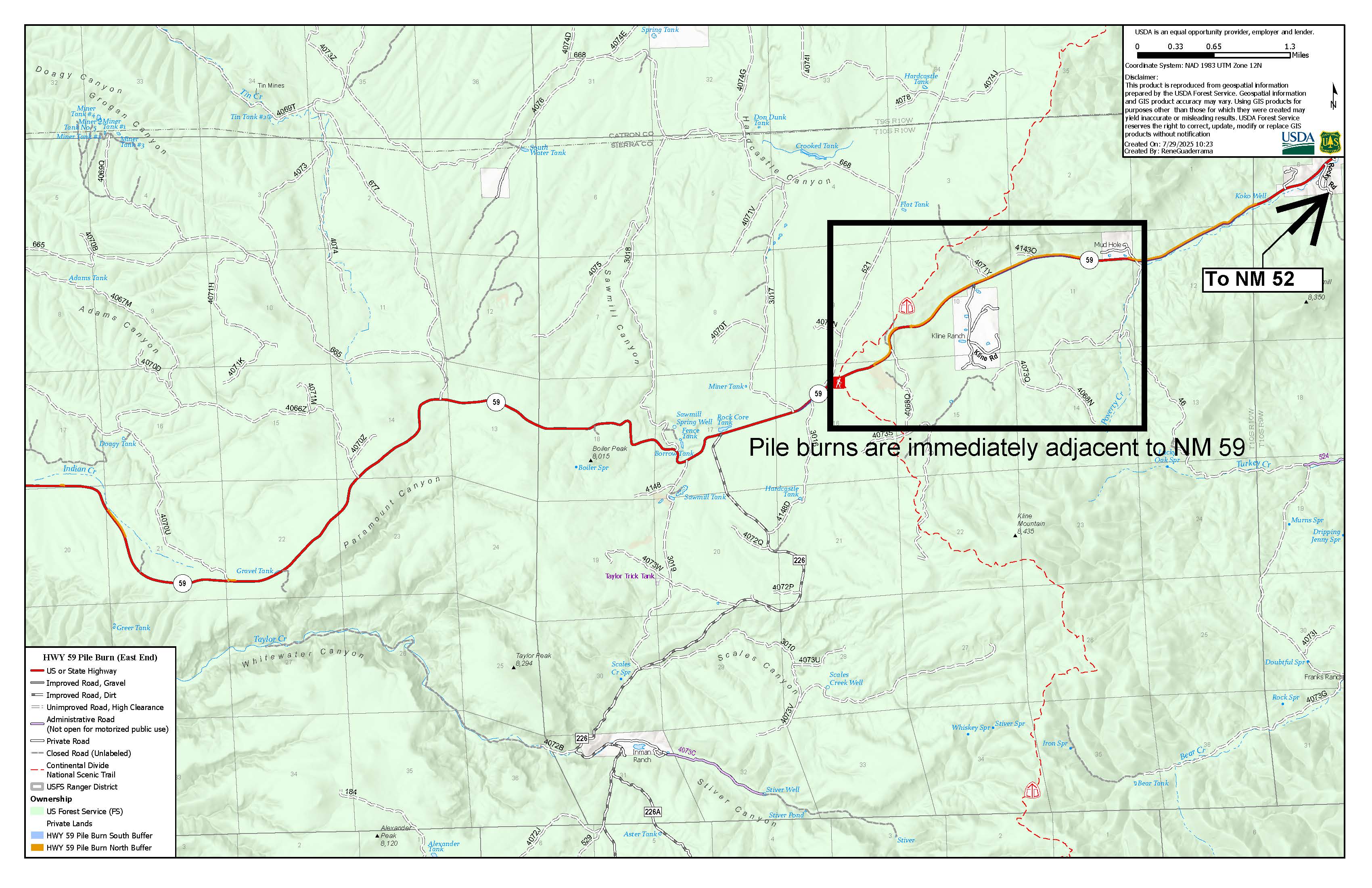
- Black Range: Slash piles west of Poverty Creek along New Mexico Highway 59 (NM 59) between mile markers 10-14, approximately 10 miles northwest of Winston, NM.
Smoke will likely impact visibility along NM 59 and portions of the Continental Divide Trail in the area.
Watch for warning signs, fire vehicles, and firefighters along roadways near all prescribed fire areas before and during burns. Slow down and turn on your headlights if you encounter smoke on the road. Smoke may settle into valley areas, especially during overnight and early morning hours. For more detailed information about air quality, visit AirNow online or download the app.
Fire staff evaluate conditions before burns and postpone or cancel ignitions as needed. Staff also patrol burn areas after ignitions, so you may see forest staff in burn areas days or weeks after initial ignitions.
The public can stay informed on scheduled prescribed fires through the forest website and social media. We will notify county emergency management officials when burning begins.


Comments are closed.