
 February 18, 2026
Favorable weather conditions in place for hazardous fuels reduction.
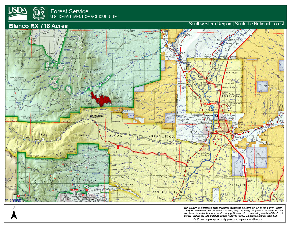
The Santa Fe National Forest is planning prescribed fire operations in the Española Ranger District as early as February 23, 2026, pending all required approvals. The Blanco prescribed fire is a 718-acre broadcast burn located off Forest Road 144 west of Clara Peak and north of Santa Clara Pueblo. Fire managers will look for opportunities to implement this burn from February 18 to March 15, as weather conditions allow. A broadcast burn is when fire is applied across a defined area or boundary to reduce overgrown vegetation to help protect local communities, infrastructure and natural resources from wildfires. This is a maintenance burn, which refers to a low to moderate intensity prescribed fire conducted to keep surface fuels reduced and continue to build a fire resilient ecosystem.
Fire managers will use hand and aerial ignitions, including a drone (UAS), over 4 days as weather conditions allow. The project area will be broken into smaller units to allow fire managers to burn smaller sections at a time. During the burn, a drone with infrared heat-detection capability will detect pockets of heat near containment lines, both during and after ignitions.
The area may be closed for several days for public safety. Watch for warning signs along roads near all prescribed fire areas before and during burns.
Residents may experience smoke during the prescribed burn. Smoke will be visible from Española, Los Alamos, and Santa Fe and surrounding communities off U.S. Route 84 including Chili, Hernandez, and Abiquiu. For more detailed information about air quality, go to AirNow online or download the app. When driving, slow down and turn on your headlights when you encounter smoke on the road.
We will evaluate weather conditions in the hours before a burn begins. If conditions warrant, scheduled prescribed fire activities may be canceled.
Stay informed about scheduled prescribed fires through the forest website, social media channels, and InciWeb, the interagency incident information system. We will notify county emergency management officials when burning begins.
About the Forest Service: The USDA Forest Service has for more than 100 years brought people and communities together to answer the call of conservation. Grounded in world-class science and technology– and rooted in communities–the Forest Service connects people to nature and to each other. The Forest Service cares for shared natural resources in ways that promote lasting economic, ecological, and social vitality. The agency manages 193 million acres of public land, provides assistance to state and private landowners, maintains the largest wildland fire and forestry research organizations in the world. The Forest Service also has either a direct or indirect role in stewardship of about 900 million forested acres within the U.S., of which over 130 million acres are urban forests where most Americans live.
USDA is an equal opportunity provider, employer and lender.


Comments are closed.