
 April 22, 2022
This will be the final update for Nogal Canyon and McBride Fires unless there is a significant change.
Today is an Extreme Critical Fire Weather Day
McBride Fire Stats
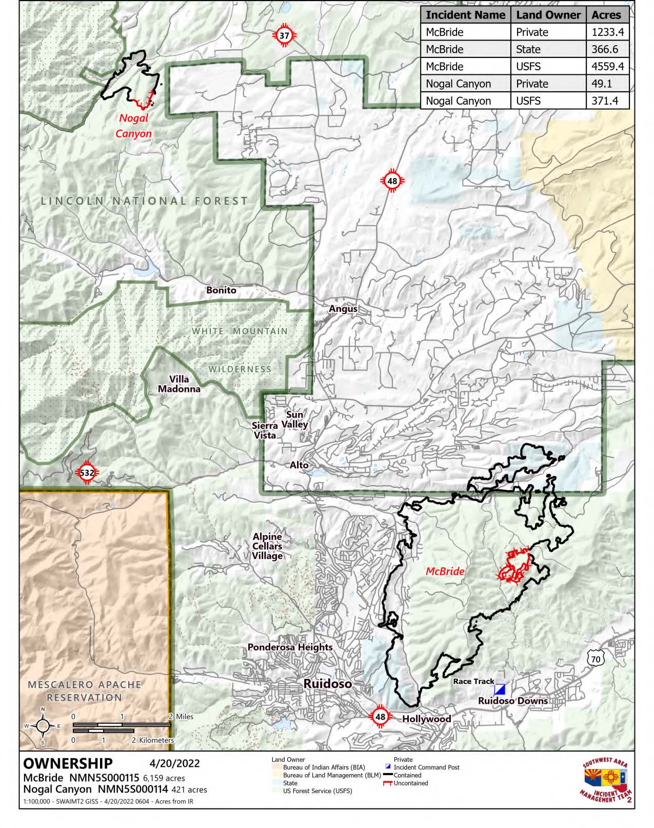
Acres: 6,159
Cause: Under investigation
Containment: 89%
Location: Gavilan Canyon within the Village of Ruidoso that spread to state and Lincoln National Forest
Start Date: April 12, 2022
Fuels: Timber, brush, grasses
Structures burned: 207 primary structures, multiple outbuildings
Fatalities: 2 citizens
Nogal Canyon Fire Stats
Acres: 412
Cause: Downed power lines
Containment: 84%
Start Date: April 12, 2022
Location/Origin: Nogal Canyon, west of Capitan
Fuels: Ponderosa pine, pinon and juniper, grasses
Structures burned: 6 primary, 8 outbuildings
Fatalities/Injuries: None
Highlights: Both the Nogal Canyon and McBride Fires were transferred to a Type 4 Command structure on April 21st at 7:00 am.
Safety: Today is an Extremely Critical Fire Weather Day. There are red flag warnings in effect. Lincoln County, the Village of Ruidoso, Otero County and the Lincoln National Forest are ALL under fire restrictions or burn bans. Please do not burn debris, weld or have campfires on red flag warning days.
Operations: Minimal fire activity was observed across the fire as crews continued to patrol and monitor the fire. An excavator was used alongside ground crews to support suppression repair work in the Eagle Creek area. Small pockets of smoldering debris will continue to produce smoke over the coming days and weeks. This is very common after a fire. As the fire continues to release resources, a group remains available for initial attack for any new fire starts.
After the Fire: Citizens whose property sustained damage in either fire and need paperwork for insurance claims can contact the Ruidoso Community Development Office at 575-258-6999.
Flooding and other adverse effects are common after a fire. A Burned Area Emergency Response (BAER) team has begun assessments for the McBride and Nogal Canyon Fires. BAER teams evaluate post-fire conditions and determine the potential for increased flooding, mudslides, and rockslides. The team consist of hydrologists, geologists, soil scientists, road engineers, botanists, biologists, and archeologists from both federal and state agencies. Efforts are focused on the protection of human life and safety, property, and critical cultural and natural resource values. The BAER assessment will take approximately two weeks to complete their burned area assessment.
Weather: Temperatures in the mid-70s and strong southwest winds are expected at 40 mph with gusts 60-70 mph.
Fire Information: Public 575-258-6900 Media 505-681-2837
InciWeb: https://inciweb.nwcg.gov/
Facebook: http://www.facebook.com/McBrideFire2022 and www.facebook.com/NogalCanyonFire2022


Comments are closed.