
 June 2, 2022
Aerial Resources Continue to Support Firefighters
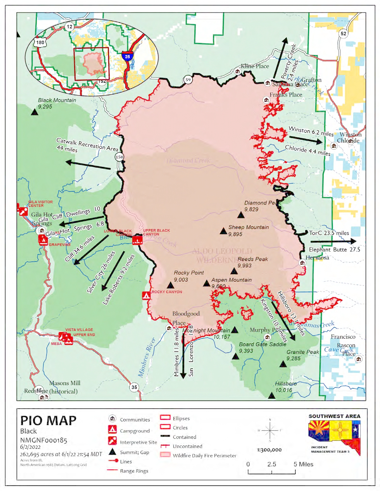
| Acres: 262,695 acres Location: 31 miles NW of T or C, NM Containment: 26% Personnel: 831 | Start Date: Friday, May 13, 2022 Cause: Human-caused, under investigation Fuels: Timber and tall grass Structures Lost: 2 |
Community meeting Friday, June 3, 2022, 6 p.m. at the Black Range Lodge in Kingston, NM.
Interactive Evacuation Map: A real-time, interactive evacuation map is now available. The map provides current information on evacuation status for the Black Fire. For individual inquiries, please contact your local jurisdiction’s emergency management agencies.
The Black Fire is burning in extremely dry timber and tall grass fuels. Fine fuel loading is very high due to robust monsoons in 2021 and is contributing to the high rates of spread through unburned areas. Hot temperatures and winds continue to move the fire through fine grasses and into heavy fuels. Aircraft has been busy supporting firefighters on the ground by dropping water on hotspots along the fires edge, to slow fires spread.
Activity increased on the northeast side Wednesday, but with the use of firefighters and a Type 1 helicopter, the fire held in its current footprint with no growth to the east. On the south and southeast sides of the fire, wind continues to push the fire into canyons and drainages. Again, aircraft played an important role throughout the day, supporting firefighters on the ground. Firefighters continue to look for control features that could be used to slow or contain the southern edge of the fire.
Weather: An upper-level disturbance may bring a slight chance for an afternoon thunderstorm today, but most of the thunderstorm activity will remain east of the fire. The main risk will be outflow winds from the storms. Overnight recoveries will be good tonight into Friday morning. Expect similar conditions on Friday with isolated afternoon thunderstorms. Temperatures will be in the mid to high 80’s with relative humidity 8-12%, with winds 12-18 mph.
Closures: Highway 59 is closed from Mud Hole to the 59/150 intersection. Forest Road 150 is also closed at the North Star Helispot. I-25 and other state highways remain open. A portion of the Gila National Forest affected by the fire has been closed.
Aviation Restrictions: A Temporary Flight Restriction (TFR) over the Black Fire restricts non-fire aircraft. This includes civilian drones. Unauthorized aircraft in the area can ground firefighting aircraft, hinder firefighting efforts, and can also result in criminal charges for the offender.
Fire Restrictions: Know Before You Go! The public can obtain current state and federal fire restriction information across New Mexico at NM Fire Info | Fire Restrictions or at NM Forestry Division state-wide fire restrictions: https://www.emnrd.nm.gov/sfd/find-current-fire-restrictions/
More Information:
• InciWeb: https://inciweb.nwcg.gov/incident/8103/
• Facebook: https://www.facebook.com/GilaNForest
• New Mexico Fire information: https://nmfireinfo.com/
• Twitter: https://twitter.com/gilanforest
• New Mexico Road Information: https://www.nmroads.com/
• Smoke Outlook Report: https://outlooks.airfire.org/outlook/dde9ec52
• Sierra County: https://www.sierraco.org/department/emergency-management/
• Catron County: https://www.catroncounty.us/departments/fire_chief/
• Grant County: https://grantcountynm.gov/departments/emergency-management/
• Firewise: https://www.emnrd.nm.gov/sfd/fire-prevention-programs/firewise-usa/


Comments are closed.