
 June 5, 2022
Black Fire Produces Huge Smoke Plumes Yesterday
due to Heavy Fuels Burning in the Board Gate Saddle Area
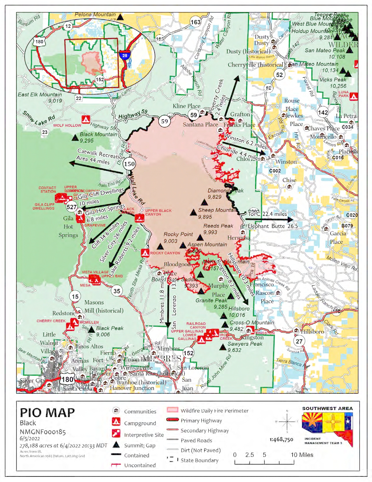
Acres: 278,188 acres
Containment: 27%
Personnel: 883
Location: 31 miles NW of Truth or Consequences
Start Date: Friday, May 13, 2022
Cause: Human-caused, under investigation
Fuels: Timber and tall grass
Structures Lost: 2
To learn about the current evacuation status for the Black Fire, please access the real-time, interactive evacuation map. or contact your local jurisdiction’s emergency management agencies.
Yesterday, the Black Fire produced a large smoke plume due to heavy fuels burning in the Board Gate Saddle area in the McKnight Canyon, which was anticipated by fire managers. The fire also crossed Las Animas Creek near the Round Mountain and Dunn place too. These two areas were the most active parts of the fire.
Firefighters are working day and night shifts, using direct (creating hand line against the fire’s edge) and indirect (building fire line using existing roads and bulldozers) tactics to fully suppress the fire. No fire growth has been reported in the Turkey and Bear Creek areas for the past few days and these areas will be monitored and patrolled. Firefighters continue using chipping operations and removing burnt trees along the existing containment lines. Air operations will be used as necessary to assist firefighters on the ground as weather conditions allow.
The Southwest’s typical fire season conditions of hot temperatures, high winds, low humidity levels, and rugged terrain are barriers to fighting this fire. All efforts are being used to fully suppress the fire while ensuring firefighter and public safety remains our top priority.
Weather: Dry weather and warmer temperatures will prevail over the fire today, with relative humidity falling into the mid to single digits. The winds will continue to be out of the southwest this afternoon, with a few gusts up to 30 mph. There will continue to be poor overnight relative humidity recoveries.
Closures: Highway 59 is closed from Mud Hole to the 59/150 intersection. Forest Road 150 is also closed at the North Star Helispot. I-25 and other state highways remain open. A portion of the Gila National Forest affected by the fire has been closed.
Aviation Restrictions: A Temporary Flight Restriction (TFR) over the Black Fire restricts non-fire aircraft. This includes civilian drones. Unauthorized aircraft in the area can ground firefighting aircraft, hinder firefighting efforts, and can also result in criminal charges for the offender.
Fire Restrictions: Know Before You Go! The public can obtain current state and federal fire restriction information across New Mexico at NM Fire Info | Fire Restrictions or at NM Forestry Division state-wide fire restrictions: https://www.emnrd.nm.gov/sfd/find-current-fire-restrictions/
More Information:
- InciWeb: https://inciweb.nwcg.gov/incident/8103/
- Facebook: https://www.facebook.com/GilaNForest
- New Mexico Fire information: https://nmfireinfo.com/
- Twitter: https://twitter.com/gilanforest
- New Mexico Road Information: www.nmroads.com/
- Smoke Outlook Report: https://outlooks.airfire.org/outlook/dde9ec52
- Sierra County: https://www.sierraco.org/department/emergency-management/
- Catron County: https://www.catroncounty.us/departments/fire_chief/
- Grant County: https://grantcountynm.gov/departments/emergency-management/
- Firewise: https://www.emnrd.nm.gov/sfd/fire-prevention-programs/firewise-usa/


Comments are closed.