
 June 6, 2022
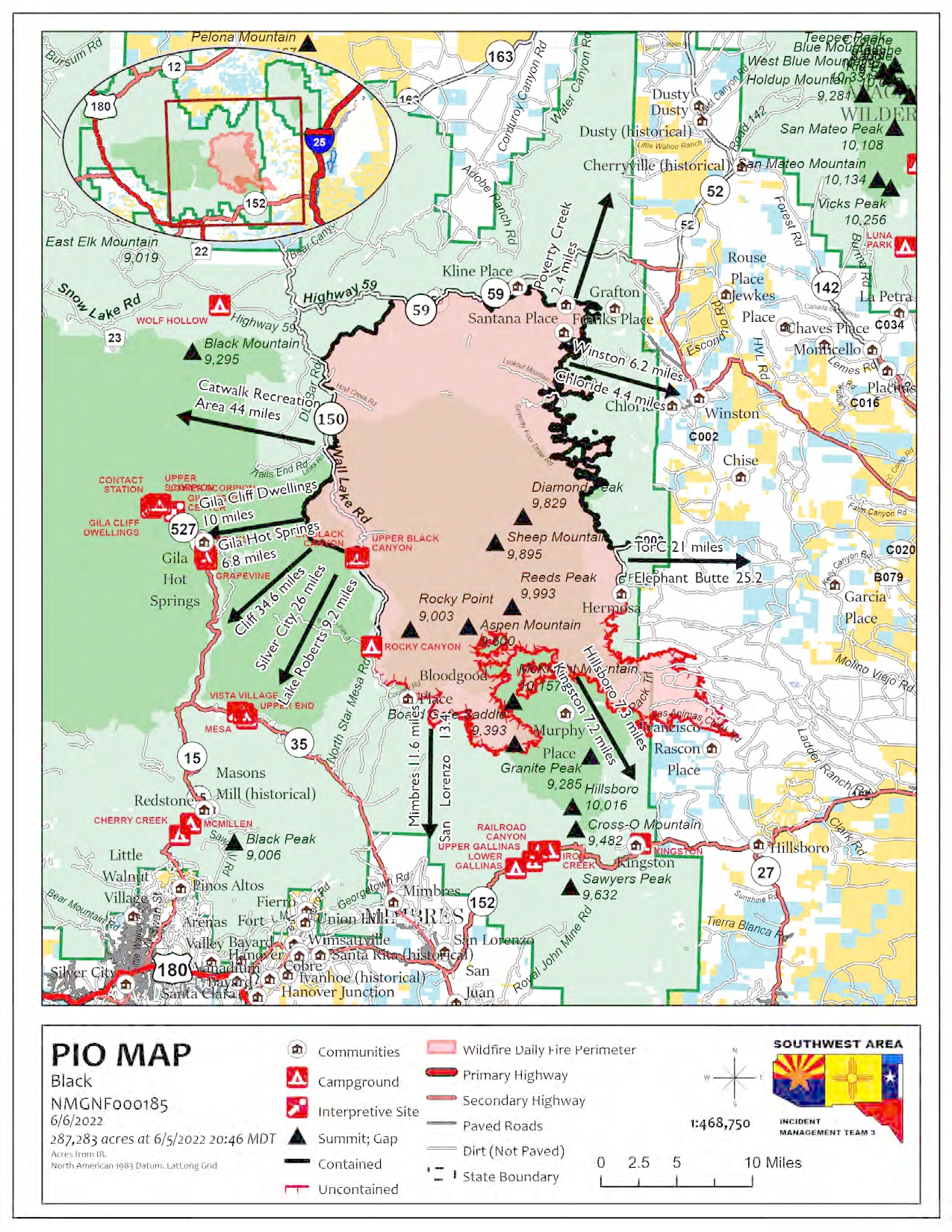
Containment Increases on the Northeast Side of the Black Fire
Community Meeting Tonight at 6 PM
Acres: 287,273 acres
Containment: 49%
Personnel: 833
Location: 31 miles NW of Truth or Consequences
Start Date: Friday, May 13, 2022
Cause: Human-caused, under investigation
Fuels: Timber and tall grass
Structures Lost: 2
Community Meeting Tonight at 6 p.m. in Mimbres
Camp Thunderbird, 3951 Hwy 35, Mimbres, (mile marker 13.5)
To learn about the current evacuation status for the Black Fire, please access the real-time, interactive evacuation map. or contact your local jurisdiction’s emergency management agencies.
Firefighter’s hard work around the clock has resulted in increased containment on the northeast and northwest corners of the Black Fire. The most active part of the fire remains along the southeastern edge near Round Mountain and McKnight Canyon. Firefighters are actively working along the fire’s edge near Round Mountain, Dunn Place, Apache Peak, and the Seco Creek drainages. A Hotshot crew hiked into the Rabb Park area to build hand line along the trail system. Firefighters have placed aluminum wrap on the Wright’s, Noon Day cabins, and Hillsboro Peak Lookout to protect these structures. The McKnight cabin was not damaged by the fire activity Sunday. Fire suppression repair chipping activities continue along the existing containment lines.
More firefighters are working in the Kingston area and a temporary fire spike camp has been established in Kingston. Therefore, fire traffic has increased along Highway 152, so please use extra caution if driving in this area.
Weather: Dry weather and warmer temperatures will prevail over the fire today, with relative humidity falling into the mid to single digits. The winds will continue to be out of the southwest, with a few gusts up to 30 mph. There will continue to be poor overnight relative humidity recoveries.
Closures: Highway 59 is closed from Mud Hole to the 59/150 intersection. Forest Road 150 is also closed at the North Star Helispot. I-25 and other state highways remain open. A portion of the Gila National Forest affected by the fire has been closed.
Aviation Restrictions: A Temporary Flight Restriction (TFR) over the Black Fire restricts non-fire aircraft. This includes civilian drones. Unauthorized aircraft in the area can ground firefighting aircraft, hinder firefighting efforts, and can also result in criminal charges for the offender.
Fire Restrictions: Know Before You Go! The public can obtain current state and federal fire restriction information across New Mexico at NM Fire Info | Fire Restrictions or at NM Forestry Division state-wide fire restrictions: https://www.emnrd.nm.gov/sfd/find-current-fire-restrictions/
More Information:
- InciWeb: https://inciweb.nwcg.gov/incident/8103/
- Facebook: https://www.facebook.com/GilaNForest
- New Mexico Fire information: https://nmfireinfo.com/
- Twitter: https://twitter.com/gilanforest
- New Mexico Road Information: www.nmroads.com/
- Smoke Outlook Report: https://outlooks.airfire.org/outlook/dde9ec52
- Sierra County: https://www.sierraco.org/department/emergency-management/
- Catron County: https://www.catroncounty.us/departments/fire_chief/
- Grant County: https://grantcountynm.gov/departments/emergency-management/
- Firewise: https://www.emnrd.nm.gov/sfd/fire-prevention-programs/firewise-usa/


Comments are closed.