
 May 5, 2023
Update 6:30 p.m. 5/5/23: This evening, crews continue to mop up along the fire’s edge and secure lines. The day’s containment strategies proved effective against the prevailing winds. Persistent interior pockets have begun to burn themselves out. Angel Fire and Cochiti crews will remain on the fire overnight. Containment remains at 40%. This will be the last notification unless significant changes occur.
Update 10 a.m. 5/5/23: The Big Tank fire’s containment lines held through the night, with patrols monitoring. This morning, the fire is at 40% containment and 1181 acres burned. State, tribal and local resources will continue to secure lines and mop-up the graded line perimeter.
Yesterday’s activity saw fire behavior creeping, running and torching interior junipers. The fire slopped over the line at two points, but a grader was able to expand line along the north, east and south flanks of the fire and tie them into cold black.
Red Flag Warnings are in place for the fire area until 8 p.m. this evening. A Fire Weather Watch is in place for the area through Sunday due to daily rounds of strong southwest winds, low humidity, warm temperatures, and an unstable airmass.
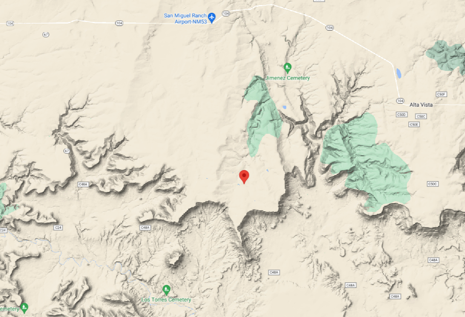
First 12 p.m. 5/4/23: The Big Tank fire is burning east of Las Vegas south of Highway 104, in San Miguel County. The fire is at 30% containment and has burned through 859 acres, fueled by grass and pinyon/juniper. No structures have been lost and none are currently threatened.
The fire was caused by lightning and discovered at 12:30 a.m. this morning. Multiple San Miguel County volunteer fire departments responded and proceeded work on containment.
This morning, Forestry Division came online to assist with response. Currently, all resources are working to secure the perimeter, which includes active flame on the northeast flank moving south. A Red Flag Warning has been issued for the area, and winds are expected to increase from their current speeds of 15 mph from the southwest.
Start Date & Time: 5/4/23 @ 0030
Start Location: 15 miles east of Las Vegas NM, near Highway 104 mile marker 15
Latitude: N 35.47764
Longitude: W -104.90214
Cause of Fire: Lightning
Area Vegetation: Grass, Pinyon/ Juniper
Estimated Acres Burned: 1181
Ownership(s): Private
Structures Threatened: None
Structures Burned: None
Evacuations (Y or N & #): None
—
George Ducker
Communications Coordinator
New Mexico State Forestry Division – EMNRD


Comments are closed.