
 June 23, 2026
La información diaria sobre el Incendio Rio está disponible en español en la Inciweb y en la página web del Santa Fe National Forest.
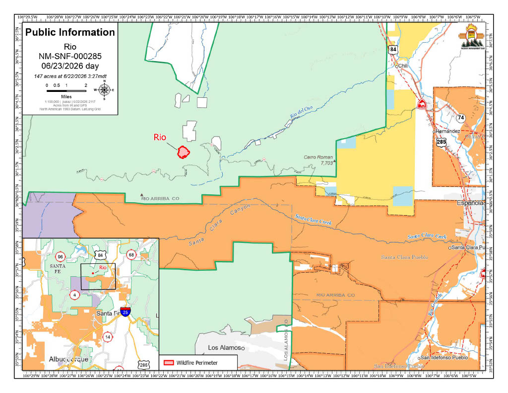
Acres: 147
Start Date: June 16, 2026
Location: Mesa De La Gallina, 3 miles northeast of Chicoma Peak
Fuels: Oak, Ponderosa, Locust
Containment: 31% Personnel: 124
Cause: Lightning
Highlights: The acreage has been adjusted due to more accurate mapping. Containment of the Rio Fire has increased to 31% and is expected to continue going up in the coming days. While there is handline around the entire perimeter of the fire, crews are locating and cooling areas of heat that could still threaten lines. Areas are not considered “contained” until fire managers are confident the fire will remain within the lines under expected conditions.
Two of the Interagency Hotshot Crews (IHCs) have been reassigned to higher-priority incidents. The Incident Management Team is evaluating resource needs daily and adjusting staffing as conditions warrant.
Operations: The Navajo and Santa Fe IHCs, along with several engine crews, are focused on strengthening control lines and identifying and cooling residual heat along the fire’s edges. While no helicopter water drops were necessary on Monday, a type three helicopter delivered strong, flexible waterbags, known as “blivets,” for firefighters to use in these mop-up operations.
Heavy equipment operators continue to work on road improvements to enable safer, more efficient firefighter access to the fire as suppression and repair efforts continue.
Resource advisors are working closely with fire managers on a suppression repair plan. The plan provides direction for repairing and rehabilitating control lines, installing water bars for erosion control where necessary, repairing fences damaged by suppression efforts, and reseeding disturbed areas where appropriate.
Safety: The primary objective for the Rio Fire is firefighter and public safety. A Temporary Flight Restriction (TFR) is in place to keep the area clear for responding aircraft. No drones or aircraft are allowed to fly in the area. Flying will force air resources to be grounded immediately. If you fly, they can’t.
Weather: Today will be another exceptionally dry day. South winds this afternoon will decrease in strength as they shift to southwest later in the day. Overnight humidity recoveries will remain poor. Wednesday’s forecast remains similar; however, towards the end of the week, there will be an increased chance of showers and thunderstorms.
Smoke: Minimal smoke may be visible from Taos, Espanola, Abiquiu, Santa Fe, and Los Alamos County. View an interactive smoke map at https://fire.airnow.gov/. Learn more about smoke impacts at https://nmtracking.org/environment/air/FireAndSmoke.html.
Closures: No closures currently, but people are asked to avoid the area and exercise extreme caution as firefighting operations are ongoing
Fire Information: 505-273-7205 / facebook.com/santafeNF/ https://x.com/SantafeNF/ 2026.rio@firenet.gov/ nmfireinfo.com


Comments are closed.