
 June 29, 2026
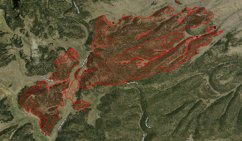
An overnight infrared flight gave Beehive Fire managers a more accurate look at the fire’s current size, which is 3,121 acres. There was no significant growth overnight.
The Northern New Mexico Type 3 Incident Management Team took command of the fire’s management today at 6 a.m. Meanwhile, crews are back on scene, using a direct extinguishment strategy, stopping flames at the fire’s edge, as much as possible, focusing on protecting private land within the forest. Aircraft will assist where needed. Containment remains at 0%.
While there is not a Red Flag Warning today, winds are forecast to be 20-25 mph, with gusts up to 35 mph. Temperatures will be in the mid-70s with the relative humidity dipping to near single digits.
SAFETY
Fire managers are asking drivers to take caution and slow down when in the area, as periods of heavy smoke are occurring along highways 64 and 285.
Hikers on the Continental Divide National Scenic Trail may want to consider skipping the section between Hopewell Lake and the Rio Grande National Forest.
FIRE RESTRICTIONS
Stage 1 fire restrictions remain in effect, increasing to Stage 2 at 8 a.m. on Tuesday.
BACKGROUND
The Beehive Fire was first reported at about 1 p.m. on June 26 to the north of Highway 64 in the Tusas Valley, about 15 miles west of Tres Piedras. It was first called in by the crew of a detection flight, which was ordered to survey the forest after recent lightning activity.
(Map: Beehive Fire perimeter, between the start point at the southwest end and the Lamy Peak area at the northeast end)


Comments are closed.