
 July 5, 2026
Northern New Mexico Type 3 Incident Management Team
STEVEN GRIEGO – INCIDENT COMMANDER
Acres: 4,729 Start Date: June 26, 2026
Containment: 43% Fuels: Timber, grass and understory
Cause: Undetermined Personnel: 237
Location: 15 miles west of Tres Piedras, north of Hwy 64
Highlights: Firefighters continue to make significant progress, with containment now at 43%. Fire managers also evaluated the potential use of firing operations in unburned pockets of fuel within the fire perimeter but determined that the risks outweighed the potential benefits. As a result, no firing operations occurred and none are planned at this time. An Initial Attack group remains available to respond to any new fire starts. As containment continues to increase and objectives are met, some resources are being released as part of right-sizing the incident management organization. The Temporary Flight Restriction placed over the fire area will be lifted today.
Operations: Yesterday, firefighters focused on mopping up remaining heat along the northern perimeter, strengthening containment lines and continuing initial suppression repair activities on the southern portion of the fire. Crews will continue this work today, targeting lingering hotspots and addressing areas of concern to keep the fire within its current boundaries while minimizing impacts from suppression operations.
As mop-up progresses and areas of the fire become secure, firefighters are transitioning to suppression repair, especially along the southern perimeter. Crews will be actively scouting areas to assess repair needs. This phase addresses impacts left behind by firefighting activities to help prevent long-term issues after the fire is contained. Suppression repair includes rehabilitating dozer lines, handlines and areas used by heavy equipment to stabilize soils, restore natural contours, reduce erosion and sediment runoff, improve safety and support faster landscape recovery.
Smoke: For current smoke conditions, view the interactive smoke map at https://fire.airnow.gov/. Learn more about protecting yourself from wildfire smoke and its health impacts at https://nmtracking.org/environment/air/FireAndSmoke.html.
Weather & Fire Behavior: A few isolated showers may develop in the afternoon. Most of the rain is expected to evaporate before reaching the ground, but these storms can still produce sudden, gusty winds that may briefly increase fire activity and cause the fire to spread in changing directions. Chances of rain are expected to increase early next week as more moisture moves into the area. Outside of any showers or thunderstorms, winds will remain light (generally less than 10 mph) over the next several days.
Fire Restrictions & Closures: A Beehive Fire road closure is in effect. The closure includes Forest Service Roads 83, 421, 576 and 133, from Highway 64 to its intersection with Forest Service Road 133E1. Closure information can be found at: https://bit.ly/Beehive-Fire-Road-Closures. The Carson National Forest is currently in Stage 2 fire restrictions. You can find more information at: https://bit.ly/CarsonNF-Fire-Restrictions.
Fire Information: 505-273-7205/ www.facebook.com/CarsonNF / 2026.beehive.nm@firenet.gov / nmfireinfo.com / https://bit.ly/Beehive-Fire-2026
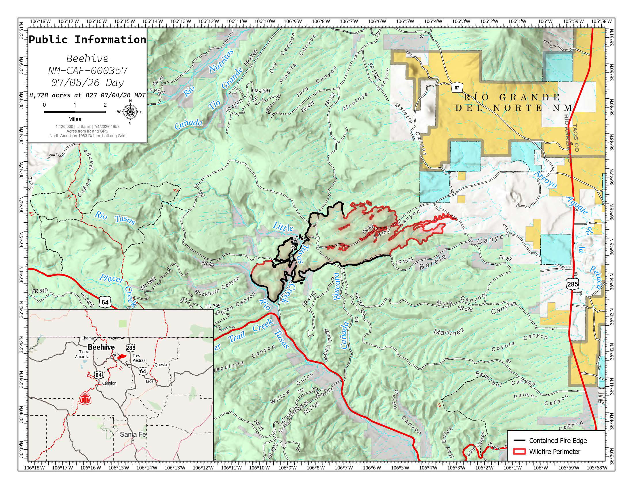
The latest Beehive Fire map shows continued progress in containment, with firefighters securing portions of the fire perimeter and continuing mop-up operations. The fire is estimated at 4,728 acres as of July 5, 2026. Crews remain focused on extinguishing remaining hotspots and strengthening containment lines to prevent further spread.


Comments are closed.