
 July 29, 2026
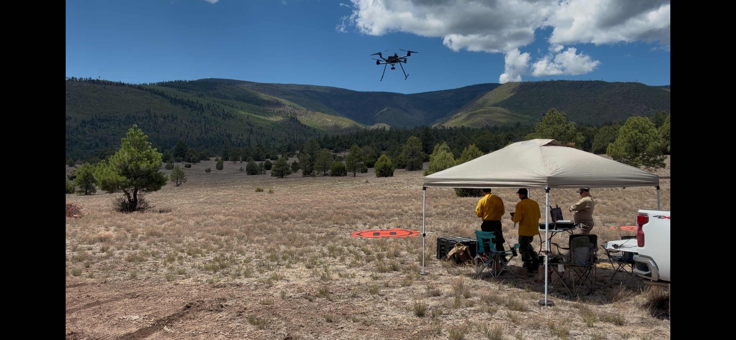
UAS Module conducts reconnaissance flights while crews put out hotspots
Acres: 26.7
Start Date: July 26, 2026
Location: Oso Canyon, 2 miles northeast of Chicoma Mountain
Fuels: Timber and brush.
Containment: 0%
Personnel: 30
Cause: Lightning
Santa Fe, NM, July 29, 2026 — The Oso Canyon Fire was discovered during the early afternoon of July 26 west of Española in Rio del Oso Canyon near Chicoma Mountain on the Española Ranger District. Updated mapping from UAS (Uncrewed Aircraft System) reconnaissance and hotspot detection has refined the fire perimeter, resulting in a reduction of the estimated acreage. Firefighters continue constructing and improving containment line while locating and extinguishing remaining hotspots to secure the fire’s perimeter.
Operations: Firefighters remained on the fire overnight, monitoring conditions and patrolling the perimeter. Thanks to firefighter efforts and recent rainfall, the fire showed no additional growth. Today, crews continue constructing containment lines and extinguishing hotspots throughout the incident area. Dense brush and heavy concentrations of dead and down fuels continue to produce isolated pockets of heat along the fire’s perimeter and within the interior, requiring careful mop-up operations. A UAS module has arrived on the incident and is conducting reconnaissance flights. These flights have provided more accurate mapping of the fire perimeter, improved identification of hotspot locations, and enhanced situational awareness by identifying potential hazards for firefighters.
Safety: The primary objective for the Oso Canyon Fire is firefighter and public safety. No privately owned drones are allowed to fly in the area. Flying will force air resources to be grounded immediately. If you fly, they can’t.
Weather: Highs around 87°F with increasing cloud cover. Scattered thunderstorms are expected after 2:00 p.m., producing frequent lightning, outflow winds of 30–45 mph, and brief heavy rainfall. Expect rapid wind shifts and localized increases in fire behavior near thunderstorm outflows. Crews should monitor weather throughout the operational period and verify safety zones and escape routes before storms develop.
Smoke: Smoke activity has lessened significantly with a low potential of being seen at great distance. Smoke could potentially be visible from Espanola, Pojoaque, Ohkay Owingeh, and Mendenales.
Closures: No closures are in effect, however, people are asked to avoid the area and exercise extreme caution as firefighting operations are ongoing.


Comments are closed.