
 April 19, 2022
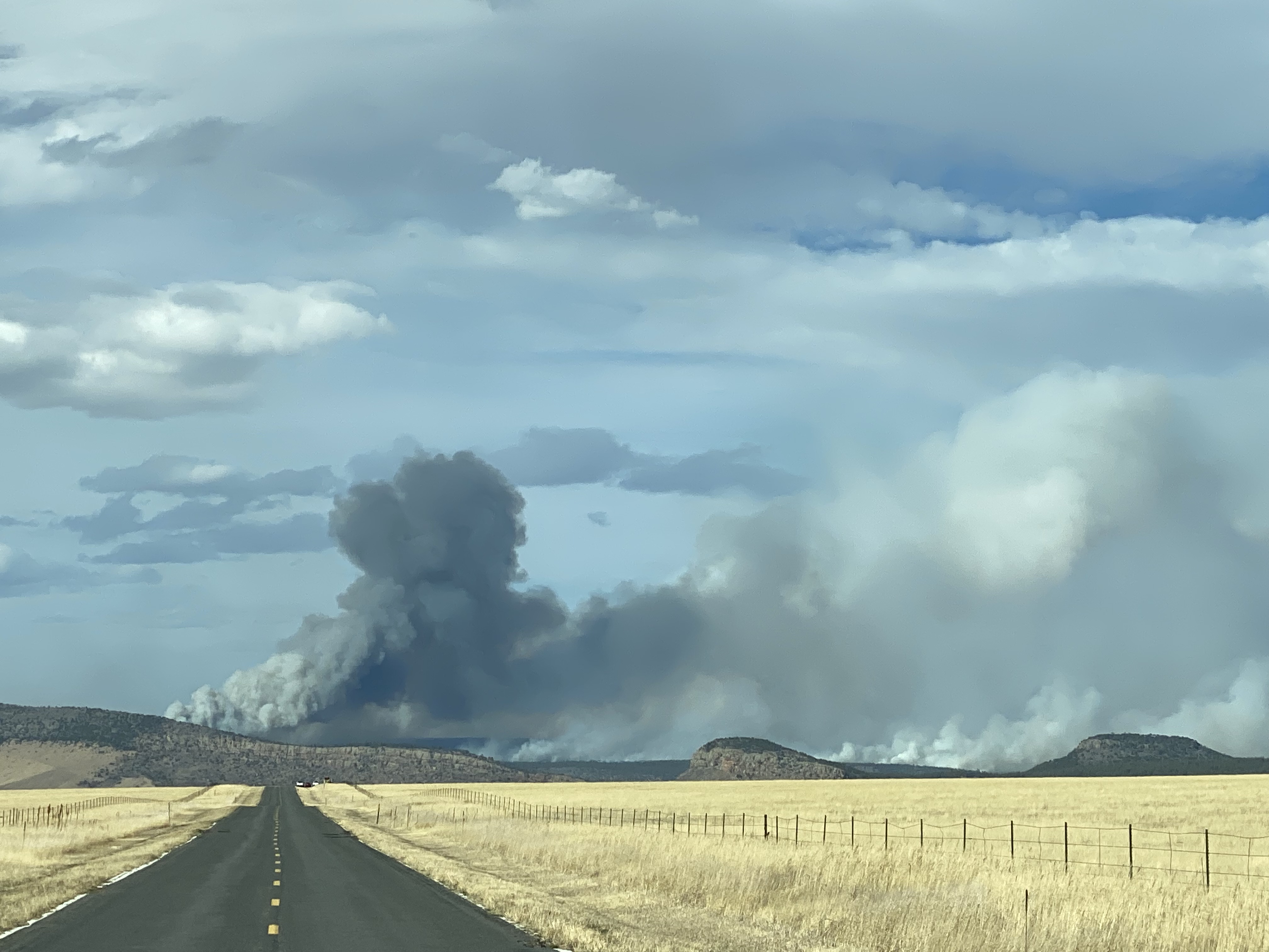
The Cooks Peak Fire, located on private land north of Ocate in Mora County, remains very active tonight as winds continue to persist over the fire area. Winds are forecast to be 30 to 40 miles per hour sustained with gusts to 60 mph through Wednesday morning (04/20). Significant fire growth was observed today to the northeast toward the Colfax County line. There was no new growth to the south of the fire. New acreage estimates are pending. Fire behavior is extreme with running, crowning, torching, and short-range spotting. There is more than 145 personnel assigned to the Cooks Peak Fire with more resources on order.
- The fire is estimated at 3,500 acres and 0% contained. The incident management team is requesting an infrared flight for more accurate acreage and mapping.
- The Mora and Colfax County Sheriff’s Offices are using the Ready, Set, Go! program for evacuation status. In Mora County, CR 0009 is in Go status, which means residents in this area have already evacuated. The Town of Ocate is in Ready status as well as the Colfax County communities of Sweet Water, Rayado, Sunny Side, and Miami. This means residents must be prepared to leave immediately if a full evacuation is necessary. Additional information can be found on the Mora County Sheriff’s Office Facebook page at https://www.facebook.com/moracountysheriffoffice. Deputies will conduct regular patrols along all roads surrounding the fire. Residents are urged to obey all traffic signage and closures that could change at any time.
- Smoke from the Cooks Peak Fire will continue to impact the surrounding communities, especially in northeast New Mexico. This includes Ocate, Rayado, Philmont Scout Ranch headquarters, Cimarron, and surrounding communities in Mora County and Colfax County.
Evacuation Centers: Memorial Middle School in Las Vegas, Wagon Mound Public Schools, and Mora Schools are available for evacuees if needed.
Livestock: The American Legion Pavilion is available for evacuated horses and livestock at 268 State Highway 434 in Mora. The State Land Office is also offering a pasture for large animals displaced by the fire. Contact Livestock Inspector, Matthew Romero at 575-643-6805 for more information.
Closures: County CR009 remains closed.
Smoke: Individuals sensitive to wildfire smoke should take precautions and use the New Mexico Department of Health 5-3-1 Visibility Method to determine if it’s safe to be outside. Learn more at
https://nmtracking.org/environment/air/FireAndSmoke.html. The New Mexico Department of Health and New Mexico Environment Department will issue Smoke Advisories as needed. An interactive smoke map at https://fire.airnow.gov/ allows you to zoom into your area to see the latest smoke conditions.
Fire information will be posted to the following websites.
NM Fire Info: www.nmfireinfo.com
InciWeb: https://inciweb.nwcg.gov/incident/8061/
Start Date & Time: 4/17/22 @ 1615
Start Location: Ocate off of HWY 120 Canada Bonita
Latitude: 36.24352
Longitude: -105.03793
Cause of Fire: Under investigation
Area Vegetation: Grass, pinon, juniper, ponderosa pine, and mixed conifer
Estimated Acres Burned: 3,500
Ownership(s): Private
Structures Threatened: Yes
Structures Burned: No
Evacuations: Yes, County Road C009
Wendy Mason
Wildfire Prevention & Communications Coordinator
Energy, Minerals & Natural Resources Dept. (EMNRD)
Forestry Division
wendy.mason@state.nm.us


Comments are closed.