
 June 13, 2026
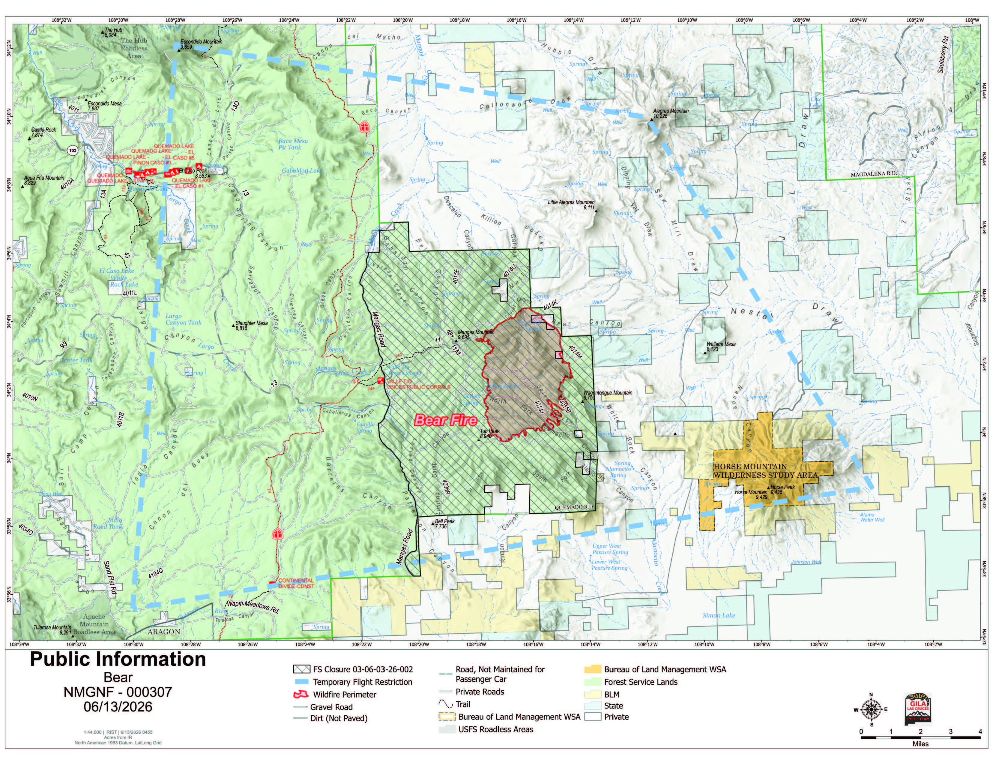
Slower Fire Growth Aids Firefighters in Making Progress on Bear Fire
Acres: 6,042.6
Start Date: June 9, 2026
Location: 18 miles southeast of Quemado, NM
Personnel: 352
Containment: 0%
Cause: Lightning
Summary: Favorable weather conditions on Friday slowed growth of the Bear Fire on the Gila National Forest. The fire is in an extreme drought-stricken area, where heavy fuel loading, recent tree mortality and steep terrain continue to challenge firefighter safety with direct tactics.
Five hotshot crews, six handcrews, two dozers, 14 engines, and nine water tenders operated across four divisions to construct and secure firelines yesterday. Firefighters secured a firing operation that occurred on the north flank overnight to protect critical power infrastructure. On the western flank and southern flank, resources prepared indirect fire lines. To the east, firefighters worked on indirect lines to protect private and New Mexico State land. Five Type 1 helicopters, four Type 3 helicopters, and large air tankers assisted ground resources. The helicopters cooled hot spots with 74,000 gallons of water.
Last night, operations conducted a defensive firing operation on the western flank, to secure Mangas Mountain communication site and lookout tower. Also on the western side, resources will continue indirect firing when conditions are optimal. On the south and east, firefighters will connect forest roads, using direct and indirect tactics to minimize fire spread with help from air resources.
Weather: A weak impulse of moisture moving across the region this weekend will raise relative humidity levels and bring a threat of thunderstorms. Starting Monday, weather turns warmer and drier.
Safety: A 24-hour Temporary Flight Restriction is also in place. If you fly, we can’t! The Gila National Forest enacted an Area Closure Order for the Bear Fire. Along with private dip sites, aircraft are sourcing water out of Quemado Lake. Members of the public should avoid all areas where firefighting operations are occurring.
Evacuations: The Catron County Emergency Management Office and Catron County Sheriffs are implementing the Ready, Set Go! method. Three of the identified zones of private land east of the fire, moved into SET status Thursday evening. Residents are encouraged to monitor official updates and be prepared for potential changing conditions.
Smoke: Smoke may be visible in and around surrounding communities. Air quality will vary based on fire activity, weather, and wind patterns. Residents should reduce prolonged outdoor activity when smoke is present and check the Air Quality Index before recreating or working outdoors. Sensitive groups should take extra precautions to limit smoke exposure. For real-time smoke conditions, visit https://fire.airnow.gov.
Fire Restrictions: The Gila National Forest is in Stage 1 Fire Restrictions due to long term severe drought in the Gila region, increased tree mortality across the forest, and forecasted hotter, drier weather conditions. Stage 1 Fire Restrictions limit campfires on forest land to designated recreation sites and campgrounds with constructed metal fire rings. Open burning is also prohibited in the unincorporated area of Catron County and in Catron County Fire District 30.
For more information:
Public Information: 2026.bear@firenet.gov
Incident Information:
Facebook: www.facebook.com/GilaNForest
InciWeb: https://inciweb.wildfire.gov/nmgnf-bear-fire


Comments are closed.