
 June 14, 2026
Moderated Weather Conditions Help Firefighters on Bear Fire
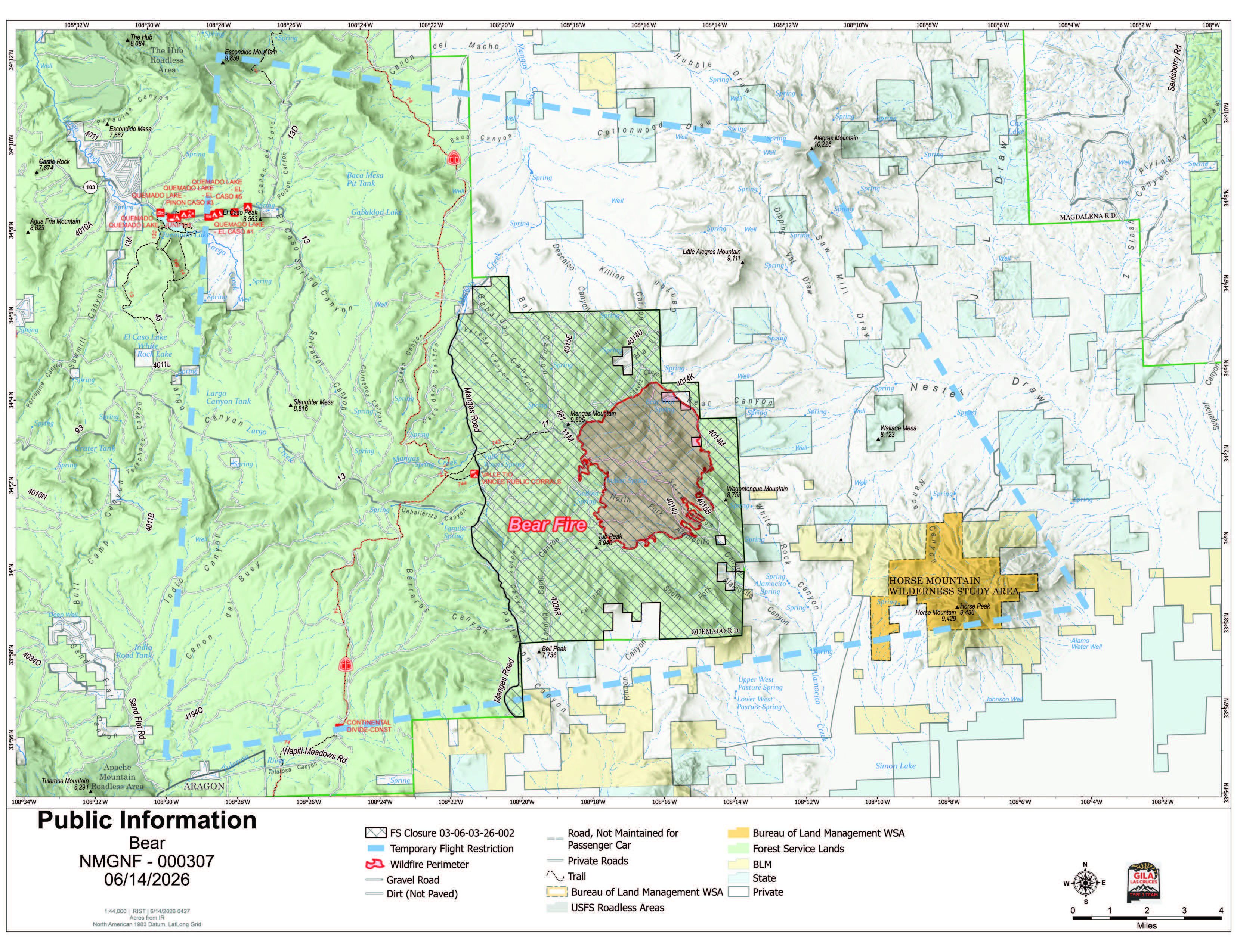
Acres: 6,654
Start Date: June 9, 2026
Location: 18 miles southeast of Quemado, NM
Personnel: 471
Containment: 3%
Cause: Lightning
Summary: Favorable weather conditions and hard work by firefighters increased containment to 3% on the Bear Fire with more containment expected today. Work continues to protect values at risk and stop fire progression.
Despite moderated weather conditions the fire behavior remained active on Saturday. The Bear Fire spread to the southwest yesterday, moving through heavy dead and down fuels.
Yesterday, ground resources carried out firing operations on the western flank to secure Mangas Mountain Lookout and communication site. Crews continued prepping indirect line as a contingency on the eastern side to protect private and state land while taking advantage of opportunities to use direct tactics when safe. Helicopters made 35 water drops, assisting ground resources. Fixed wing aircraft supported mapping and reconnaissance. Light moisture and clouds slightly tempered the fire’s activity in the afternoon.
Working overnight, crews secured the fires edge and prepared indirect fire lines on the Bear Fire. Today, firefighters plan to continue firing operations as conditions allow. On the east side of the fire, firefighters are using a mix of direct and indirect tactics along the Gila National Forest and private land boundary.
Weather: Similar to yesterday, afternoon storms are forecasted for the area surrounding the Bear Fire today. Monday’s weather transitions toward a trend of warm and dry days with breezy afternoons.
Safety: A 24-hour Temporary Flight Restriction is also in place. If you fly, we can’t! The Gila National Forest enacted an Area Closure Order for the Bear Fire. Along with private dip sites, aircraft are sourcing water out of Quemado Lake. Members of the public should avoid all areas where firefighting operations are occurring.
Evacuations: The Catron County Emergency Management Office and Catron County Sheriffs are implementing the Ready, Set Go! method. Three of the identified zones of private land east of the fire, moved into SET status Thursday evening. Residents are encouraged to monitor official updates and be prepared for potential changing conditions.
Smoke: Smoke may be visible in and around surrounding communities. Air quality will vary based on fire activity, weather, and wind patterns. Residents should reduce prolonged outdoor activity when smoke is present and check the Air Quality Index before recreating or working outdoors. Sensitive groups should take extra precautions to limit smoke exposure. For real-time smoke conditions, visit https://fire.airnow.gov.
Fire Restrictions: The Gila National Forest is in Stage 1 Fire Restrictions due to long term severe drought in the Gila region, increased tree mortality across the forest, and forecasted hotter, drier weather conditions. Stage 1 Fire Restrictions limit campfires on forest land to designated recreation sites and campgrounds with constructed metal fire rings. Open burning is also prohibited in the unincorporated area of Catron County and in Catron County Fire District 30.
For more information:
Public Information: 2026.bear@firenet.gov
Incident Information:
Facebook: www.facebook.com/GilaNForest
InciWeb: https://inciweb.wildfire.gov/nmgnf-bear-fire


Comments are closed.