
Acres: 316,353 | Containment: 54% | Total personnel: 2,892 |Start Date: Hermits Peak: April 6, 2022; Calf Canyon: April 19, 2022 | Cause: Hermits Peak: Spot fires from prescribed burn; Calf Canyon: Holdover fire from prescribed pile burn | Location: Located near Gallinas Canyon | Fuels: Heavy mixed conifer, ponderosa pine, brush, and grass Highlights: […]
Continue reading
Archive | NM Fire Info RSS feed for this section
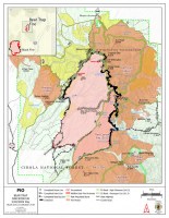

Cerro Pelado Fire Daily Update June 1, 2022
 June 1, 2022
  0 Comments
INCIDENT STATISTICS: Current Size: 45,605 Acres Current Containment: 95% Start Date: April 22, 2022 Cause: Unknown Total personnel: 157 Today will be the final update from Rocky Mountain Incident Management Team Three. TEAM TRANSITION Rocky Mountain Incident Management Team Three will be transitioning management of the Cerro Pelado Fire to the Northern New Mexico Incident […]
Continue readingBlack Fire Daily Update – June 1, 2022
June 1, 2022 0 Comments
Community Meeting Tonight at the Sapillo Creek Volunteer Fire Station Acres: 254,840 acres Location: 31 miles NW of Truth or Consequences Containment: 25% Personnel: 816 Start Date: Friday, May 13, 2022 Cause: Human-caused, under investigation Fuels: Timber and tall grass Structures Lost: 2 Reminder: Community meeting Wednesday, June 1, 2022, at 6 p.m. at the […]
Continue readingHermits Peak and Calf Canyon Fires June 1, 2022, Daily Update
June 1, 2022 0 Comments
Acres: 315,830 | Containment: 54% | Total personnel: 3,080 |Start Date: Hermits Peak: April 6, 2022; Calf Canyon: April 19, 2022 | Cause: Hermits Peak: Spot fires from prescribed burn; Calf Canyon: Holdover fire from prescribed pile burn | Location: Located near Gallinas Canyon | Fuels: Heavy mixed conifer, ponderosa pine, brush, and grass Highlights: […]
Continue readingBlack Fire Daily Update – May 31, 2022
May 31, 2022 0 Comments
Southwest Area Incident Management Team 3 Assumes Command Acres: 246,648 acres Location: 31 miles NW of Truth or Consequences Containment: 28% Personnel: 759 Start Date: Friday, May 13, 2022 Cause: Human-caused, under investigation Fuels: Timber and tall grass Structures Lost: 2 The Southwest Area Incident Management Team 3 assumed command of the Black fire Tuesday […]
Continue readingCerro Pelado Fire Daily Update Tuesday, May 31, 2022
May 31, 2022 0 Comments
Information Phone Line: 505-312-4593 Email: 2022.CerroPelado@firenet.gov InciWeb: https://inciweb.nwcg.gov/incident/8075/ Facebook: https://www.facebook.com/2022.CerroPeladoFire Twitter: https:/twitter.com/SantafeNF INCIDENT STATISTICS:Current Size: 45,605 AcresCurrent Containment: 95%Start Date: April 22, 2022 Cause: UnknownTotal personnel: 290 WEATHER AND FIRE BEHAVIOR Although the red flag warning over the fire area has been removed, increased temperatures and low humidity in the range of 9-13% will keep fire […]
Continue readingHermits Peak and Calf Canyon Fires May 31, 2022, Daily Update
May 31, 2022 0 Comments
Acres: 315,627 | Containment: 50% | Total personnel: 3,065 | Start Date: Hermits Peak: April 6, 2022; Calf Canyon: April 19, 2022 | Cause: Hermits Peak: Spot fires from prescribed burn; Calf Canyon: Holdover fire from prescribed pile burn | Location: Located near Gallinas Canyon | Fuels: Heavy mixed conifer, ponderosa pine, brush, and grass […]
Continue readingCerro Pelado Fire Daily Update Cerro Pelado Fire Daily Update
May 30, 2022 0 Comments
INCIDENT STATISTICS: Current Size: 45,605 Acres Current Containment: 95% Start Date: April 22, 2022Cause: Unknown Total personnel: 280 WEATHER AND FIRE BEHAVIOR A red flag warning remains over the fire area due to high winds and relative humidity in the single digits. With the high winds forecast today, expect to see increased smoke within the […]
Continue readingHermits Peak and Calf Canyon Fires May 30, 2022, Daily Update
May 30, 2022 0 Comments
Acres: 315,223 | Containment: 50% | Total personnel: 2,989 Start Date: Hermits Peak: April 6, 2022; Calf Canyon: April 19, 2022 | Cause: Hermits Peak: Spot fires from prescribed burn; Calf Canyon: Holdover fire from prescribed pile burn | Location: Located near Gallinas Canyon | Fuels: Heavy mixed conifer, ponderosa pine, brush, and grass Highlights: […]
Continue reading Bear Trap Fire Update – May 30, 2022
May 30, 2022 0 Comments
Acres: 38,225 acres Containment: 82% Cause: Undetermined Total Personnel: 273 Start Date: May 1, 2022 Location: San Mateo Mountains, Magdalena Ranger District, Socorro County, NM Fuels: Pine, Pinyon-Juniper and Grass Highlights: Fire lines continued to hold strong despite having the highest wind speeds in the last 11 days, gusting at 35 mph. The fire is […]
Continue readingFoster Fire
May 29, 2022 1 Comment
The Foster Fire was reported on May 29, 2022 at 1253 hours in Peloncillo Mountains on the Coronado National Forest. The fire is approximately 22 miles south of Rodeo, New Mexico in the Whitmore WSA. The SEZ Type 3 Team assumed command late this afternoon. https://inciweb.nwcg.gov/incident/8125/
Continue readingReminder – All National Forests in New Mexico Have Closures or Restrictions in Place Due to Extreme Fire Danger
May 29, 2022 0 Comments
All five National Forests in New Mexico have closures or restrictions in place due to extreme fire danger statewide. A RED FLAG WARNING is in place today, Sunday, May 29 until 10:00 p.m. The following links have details on the closures and fire restrictions currently active at all of New Mexico’s national forest locations. Lincoln […]
Continue readingIncendios de Hermits Peak y Calf Canyon 29 de mayo de 2022, Actualización diaria
May 29, 2022 0 Comments
Acres: 314,750 | Contención: 50% | Total del personal: 3,001 Fecha de inicio: Hermits Peak: 6 de abril 2022; Calf Canyon: 19 de abril 2022 | Causa: Hermits Peak: Fuegos salpicados por quemaduras prescritas; Calf Canyon: Restos de un incendio prescrito | Ubicación: Cerca de Gallinas Canyon Combustibles: Mezcla de coníferas, pino ponderosa, arbustos y […]
Continue readingCerro Pelado Fire Daily Update Sunday, May 29, 2022
May 29, 2022 0 Comments
Information Phone Line: 505-312-4593 Email: 2022.CerroPelado@firenet.gov InciWeb: https://inciweb.nwcg.gov/incident/8075/ Facebook: https://www.facebook.com/2022.CerroPeladoFire Twitter: https:/twitter.com/SantafeNF WEATHER AND FIRE BEHAVIOR Although temperatures will be cooler today, a red flag warning remains over the fire area due to winds and relative humidity remaining in the single digits. Isolated fire activity within the perimeter increased yesterday but remained within the fire and all […]
Continue readingHermits Peak and Calf Canyon Fires May 29, 2022, Daily Update
May 29, 2022 0 Comments
Acres: 314,750 | Containment: 50% | Total personnel: 3,001 Start Date: Hermits Peak: April 6, 2022; Calf Canyon: April 19, 2022 | Cause: Hermits Peak: Spot fires from prescribed burn; Calf Canyon: Holdover fire from prescribed pile burn | Location: Located near Gallinas Canyon | Fuels: Heavy mixed conifer, ponderosa pine, brush, and grass Highlights: […]
Continue reading Bear Trap Fire update for May 29, 2022
May 29, 2022 0 Comments
Acres: 38,225 acres Containment: 75% Cause: Undetermined Total Personnel: 357 Start Date: May 1, 2022 Location: San Mateo Mountains, Magdalena Ranger District, Socorro County, NM Fuels: Pine, Pinyon-Juniper and Grass Highlights: Fire lines were tested by high winds Saturday and held up well as more than three-quarters of the fire now is considered contained. Crews […]
Continue readingIncendios de Hermits Peak y Calf Canyon 28 de mayo de 2022, Actualización diaria
May 28, 2022 0 Comments
Acres: 314,228 | Contención: 48% | Total del personal: 2,950 Fecha de inicio: Hermits Peak: 6 de abril 2022; Calf Canyon: 19 de abril 2022 | Causa: Hermits Peak: Fuegos salpicados por quemaduras prescritas; Calf Canyon: Restos de un incendio prescrito | Ubicación: Cerca de Gallinas Canyon | Combustibles: Mezcla de coníferas, pino ponderosa, arbustos […]
Continue readingHermits Peak and Calf Canyon Fires May 28, 2022, Daily Update
May 28, 2022 0 Comments
Acres: 314,228 | Containment: 48% | Total personnel: 2,950Start Date: Hermits Peak: April 6, 2022; Calf Canyon: April 19, 2022 | Cause: Hermits Peak: Spot fires from prescribed burn; Calf Canyon: Holdover fire from prescribed pile burn | Location: Located near Gallinas Canyon | Fuels: Heavy mixed conifer, ponderosa pine, brush, and grass Highlights: A […]
Continue readingCerro Pelado Fire
May 28, 2022 0 Comments
Daily Update Saturday, May 28, 2022 Information Phone Line: 505-312-4593Email: 2022.CerroPelado@firenet.gov InciWeb: https://inciweb.nwcg.gov/incident/8075/ Facebook: https:/facebook.com/2022.Cerropeladofire Twitter: https:/twitter.com/SantafeNF INCIDENT STATISTICS: Current Size: 45,605 AcresCurrent Containment: 95%Start Date: April 22, 2022 Cause: UnknownTotal personnel: 463 WEATHER AND FIRE BEHAVIOR Temperatures will continue to increase over the fire area with relative humidity remaining in the single digits. Fire activity has […]
Continue readingCerro Pelado Post-Fire BAER SBS Map Released, May 27, 2022
May 27, 2022 0 Comments
May 27, 2022 BAER Information: (707) 853-4243 CERRO PELADO POST-FIRE BAER SOIL BURN SEVERITY MAP RELEASED SANTA FE, NM – May 27, 2022 – Burned Area Emergency Response (BAER) specialists from the USDA Forest Service and the US Department of Interior assessment teams have completed data gathering and analysis for the Cerro Pelado Fire. The […]
Continue reading


