
Public should avoid Rio en Medio Trailhead, Nambe Reservoir Start date: Aug. 17, 2020 Cause: Unknown Size: 5+ acres Location: Off the Rio en Medio Trail on the Española Ranger District on the Santa Fe National Forest, approximately 2 miles east/southeast of Nambe Reservoir and 5 miles north/northwest of the Santa Fe Ski Basin. Containment: […]
Continue readingDark Canyon Fire Update: August 17, 2020
 August 17, 2020
  0 Comments
Size: 2,527 acres Containment: 10% Cause: Lightning Location: 9 miles northwest of Capitan, NM Total Personnel: 45 Lat/Long: 33°40’0.16″N 105°37’42.61″W Fuel Type: Grass, piñon-juniper, ponderosa pine, dead and down forest debris Date/Time Detected: 8/4/20 at 4:30 pm Dark Canyon Fire Maps Fire Update: On Sunday, the Dark Canyon Fire received up to ¼ inch of […]
Continue readingDark Canyon Fire Update August 15, 2020: Firing Operations Planned for Today
August 15, 2020 0 Comments
Size: 1,509 acres Containment: 10% Cause: Lightning Location: 9 miles northwest of Capitan, NM Total Personnel: 120 Lat/Long: 33°40’0.16″N 105°37’42.61″W Fuel Type: Grass, piñon-juniper, ponderosa pine, dead and down forest debris Date/Time Detected: 8/4/20 at 4:30 pm Dark Canyon Fire Maps Fire Update: The Dark Canyon Fire received light precipitation yesterday afternoon moderating fire activity. […]
Continue readingGila National Forest – Windy Fire, Glenwood Ranger District
August 14, 2020 0 Comments
There is a small fire on the Glenwood Ranger District in the Gila Wilderness. The Windy Fire is approximately 15-20 acres burning in steep terrain in the Whitewater-Baldy Fire burn scar. Smoke is visible on US Hwy 180 from the area of the Aldo Leopold Vista. The Glenwood RD fire crew is monitoring from the […]
Continue readingDark Canyon Fire Update August 13, 2020: Fire Grows In Size But Is Still Within Suppression Strategy Area
August 13, 2020 0 Comments
Size: 1,324 acres Containment: 10% Cause: Lightning Location: 9 miles northwest of Capitan, NM Total Personnel: 120 Lat/Long: 33°40’0.16″N 105°37’42.61″W Fuel Type: Grass, piñon-juniper, ponderosa pine, dead and down forest debris Date/Time Detected: 8/4/20 at 4:30 pm Dark Canyon Fire Maps Fire Update: The Dark Canyon Fire remains within the Suppression Strategy Area and is […]
Continue reading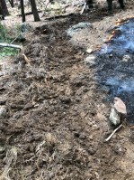
Albuquerque Zone Team Relinquishing Command of Seco Fire
August 12, 2020 0 Comments
August 12, 2020 Update Location: 3 Mi SE of Mt. Taylor Cause: Unknown Percent Contained: 76% Date Reported: 8/3/2020 Personnel: 109 Size: ~26 acres Fuel: Mixed Conifer and Ponderosa pine Resources assigned: 1 Type 3 Incident Management Team, 2 Type 2 IA Crews, 1 Engines, 2 Fire modules, 1 Helicopter, 2 water tender and various […]
Continue reading
Mopping Up on the Seco Fire
August 11, 2020 0 Comments
August 11, 2020 Update Location: 3 Mi SE of Mt. Taylor Cause: Unknown Percent Contained: 64% Date Reported: 8/3/2020 Personnel: 120 Size: ~26 acres Fuel: Mixed Conifer and Ponderosa pine Resources assigned: 1 Type 3 Incident Management Team, 2 Type 2 IA Crews, 2 Engines, 2 Fire modules, 1 Helicopter, 5 water tender and various […]
Continue reading
Quiet Day on the Seco Fire
August 10, 2020 0 Comments
August 10, 2020 Update Location: 3 Mi SE of Mt. Taylor Cause: Unknown Percent Contained: 24% Date Reported: 8/3/2020 Personnel: 120 Size: ~26 acres Fuel: Mixed Conifer and Ponderosa pine Resources assigned: 1 Type 3 Incident Management Team, 2 Type 2 IA Crews, 2 Engines, 2 Fire modules, 1 Helicopter, 5 water tender and various […]
Continue reading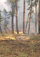
Lincoln National Forest: Dark Canyon Fire Update August 9, 2020
August 9, 2020 0 Comments
Jurisdiction: Smokey Bear Ranger District, Lincoln National Forest Size: 420 acres Cause: Lightning Date/Time Detected: August 4, 2020 at 4:30pm Location: 9 miles northwest of Capitan, NM north of Tuscon Mountain near Dark Canyon. Lat/Long: 33°40’0.16″N 105°37’42.61″W Fuel Type: Grass, piñon-juniper, ponderosa pine, dead and down forest debris Values at Risk: Private Land Fire Update: Crews […]
Continue reading
Isolated Torching Continues to Challenge Firefighters on the Seco Fire
August 9, 2020 0 Comments
August 9, 2020 Update Location: 3 Mi SE of Mt. Taylor Cause: Unknown Percent Contained: 14% Date Reported: 8/3/2020 Personnel: 127 Size: ~21.1 acres Fuel: Mixed Conifer and Ponderosa pine Resources assigned: 1 Type 3 Incident Management Team, 2 Type 2 IA Crews, 2 Engines, 2 Fire modules, 1 Air Attack, 1 Helicopter, 3 water […]
Continue reading
Lincoln National Forest: Dark Canyon Fire Update August 8, 2020: Crew Conduct Firing Operations
August 8, 2020 0 Comments
Jurisdiction: Smokey Bear Ranger District, Lincoln National Forest Size: 300 acres Cause: Lightning Date/Time Detected: August 4, 2020 at 4:30pm Location: 9 miles northwest of Capitan, NM north of Tuscon Mountain near Dark Canyon. Lat/Long: 33°40’0.16″N 105°37’42.61″W Fuel Type: Grass, piñon-juniper, ponderosa pine, dead and down forest debris Values at Risk: Private Land Dark Canyon Fire […]
Continue reading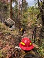
Seco Fire Increases Containment
August 8, 2020 0 Comments
August 8, 2020 Update Location: 3 Mi SE of Mt. Taylor Cause: Unknown Percent Contained: 30% Date Reported: 8/3/2020 Personnel: 125 Size: ~20 acres Fuel: Mixed Conifer and Ponderosa pine Resources assigned: 1 Type 3 Incident Management Team, 2 Type 2 IA Crews, 2 Engines, 2 Fire modules, 1 Air Attack, 1 Helicopter, 3 water […]
Continue readingLincoln National Forest: Dark Canyon Fire Update August 7, 2020
August 7, 2020 0 Comments
Dark Canyon Fire Jurisdiction: Smokey Bear Ranger District, Lincoln National Forest Size: 300 acres Cause: Lightning Date/Time Detected: August 4, 2020 at 4:30pm Location: 9 miles northwest of Capitan, NM north of Tuscon Mountain near Dark Canyon. Lat/Long: 33°40’0.16″N 105°37’42.61″W Fuel Type: Grass, piñon-juniper, ponderosa pine, dead and down forest debris Values at Risk: Private Land […]
Continue reading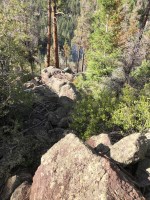
Seco Fire Crews Continue Work in Rugged Terrain
August 7, 2020 0 Comments
August 7, 2020 Location: San Mateo Mountains Cause: Unknown Percent Contained: 0% Date Reported: 8/3/2020 Personnel: 107 Size: ~20 acres Fuel: Mixed Conifer and Ponderosa pine Resources assigned: 1 Type 3 Incident Management Team, 2 Type 2 IA Crews, 2 Engines, 2 Fire modules, 1 Air Attack, 1 Helicopter, 1 water tender and various support […]
Continue readingLincoln National Forest: Dark Canyon Fire Update August 6, 2020
August 6, 2020 0 Comments
Incident Name: Dark Canyon Fire Jurisdiction: Smokey Bear Ranger District, Lincoln National Forest Size: 30 acres Cause: Lightning Date/Time Detected: August 4, 2020 at 4:30pm Location: 9 miles northwest of Capitan, NM north of Tuscon Mountain near Dark Canyon. Lat/Long: 33°40’0.16″N 105°37’42.61″W Fuel Type: Grass, piñon-juniper, ponderosa pine, dead and down forest debris Values at Risk: […]
Continue reading
Albuquerque Zone Type 3 Team Managing the Seco Fire
August 6, 2020 0 Comments
August 6, 2020 Update Location: San Mateo Mountains Cause: Unknown Percent Contained: 0% Date Reported: 8/3/2020 Size: ~20 acres Fuel: Mixed Conifer and Ponderosa pine Resources assigned: 1 Type 3 Incident Management Team, 1 Interagency Hotshot Crew, 2 Engines, 2 Fire modules, 1 Air Attack, 1 Helicopter and various support personnel from the Cibola […]
Continue readingLincoln National Forest: New Fire Start – Dark Canyon Fire (Smokey Bear Ranger District)
August 5, 2020 0 Comments
Incident Name: Dark Canyon Fire Jurisdiction: Smokey Bear Ranger District, Lincoln National Forest Size: 0.25 acre Cause: Lightning Date/Time Detected: August 4, 2020 at 4:30pm Location: 9 miles northwest of Capitan, NM north of Tuscon Mountain near Dark Canyon. Lat/Long: 33°40’0.16″N 105°37’42.61″W Firefighting Resources: 3 engines, 1 patrol unit, plus additional personnel Fuel Type: Grass, piñon-juniper, ponderosa […]
Continue readingGila National Forest: McMillan Fire – Silver City Ranger District
August 5, 2020 0 Comments
Location: Northwest of McMillan Campground, Silver City Ranger District, Gila National Forest Start Date: August 4, 2020 Cause: Lightning Size: ~1 acre Vegetation: Mixed conifer Resources: Silver City RD engines have responded Summary: The McMillan Fire is burning northwest of McMillan Campground, approximately one mile below Signal Peak between the campground and the Signal Peak […]
Continue readingCibola National Forest & National Grasslands – Final Fire Update -Vics Peak Fire 100% Contained
August 4, 2020 0 Comments
Magdalena, NM – For Immediate Release – The lightning-caused Vics Peak Fire, burning on the Magdalena Ranger District, Cibola National Forest since June 15, remains 14,624 acres and is now 100% contained. This will be the final operational update for the Vics Peak Fire barring any significant events on the fire. Minimal fire behavior was observed […]
Continue readingPile Burning in El Malpais National Monument
August 3, 2020 0 Comments
National Park Service Superintendent Kelly Fuhrmann announced that the Four Winds Fire Group will be burning wood piles in El Malpais National Monument starting Tuesday, Aug 4th and is expected to complete the project on Wednesday, Aug 5th. These wood piles are located along the west side of County Road 42 in the vicinity of […]
Continue reading


